

← Back to Property List
Holman Conservation Area
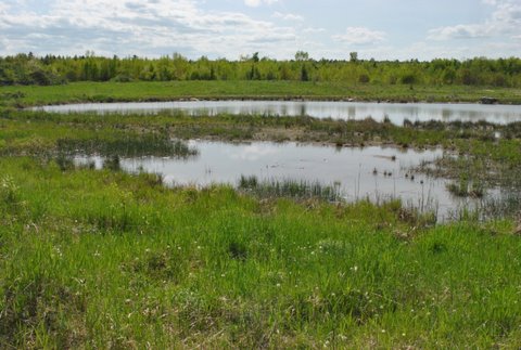
Photo: Theresa Kerchner
Location and Description:
Location: Melanie Lane, Litchfield, Maine
Property Description: Before Helen Holman reclaimed and restored this 75-acre property, gravel pits dominated this landscape. Today beautiful tree-lined paths are dominated by birches, quaking aspen, balsam fir, and northern white cedar. Ponds, wetlands, a floodplain along Jack Brook (also known as Maggoty Meadow Brook), and early successional forests provide excellent wildlife habitat for many species of birds, insects, fish, and amphibians. Beavers frequently dam and flood the banks of Jack Brook. This disturbance maintains the bluejoint grass (Calamagrostis canadensis) meadows that define this wetland. Early settlement farmers used these meadowlands as a source of hay for their cattle.
Directions from Gardiner area: Take Rt. 201 south from Gardiner. Just over 3 miles south of the Rt. 295 interchange, turn right onto Thorofare Road. Turn left on the Plains Road. Travel about 0.25 miles and take a left on Upper Pond Road. After ~ 0.5 miles, take a right onto Melanie Lane. A KLT sign and registration box is about 0.2 of a mile from Upper Pond Road.
Directions From Lewiston area: Take Rt. 126 toward Gardiner. Just past Waterman Farm Machinery, turn right onto Rt. 197. At Litchfield Corner (watch for the Brick School on the right), turn left onto the Hallowell Road. Turn right onto the Plains Road, passing the Fairgrounds on the left. Pass over the Turnpike and turn right on the Upper Pond Road; after ~ 0.5 miles turn right on to Melanie Lane.
Usage and Trails
**As you begin the hike, there is a gate blocking the road to vehicles. Hikers and skiiers can proceed around gate.
Meadow Brook Trail: This one mile trail starts from the sign-in box. At the intersection, bear left to stay on the Meadow Brook Trail.
Beaver Meadow Trail: Stay straight at the intersection with the Meadow Brook Trail to take the one-mile Beaver Meadow Trail.
Pond Trail: Bear right at the intersection with the Meadow Brook Trail to take the 0.2 mile Pond Trail.
Please note: Stay on marked trails, there are other unmarked horse trails which may be confusing.
Allowable Uses: Hiking, nature observation, cross-country skiing, snowshoeing, biking and other low impact non-motorized recreation. No motorized vehicles. Dogs are allowed on a leash or under voice command. Please clean up after your pets. Landowner permission is required for hunting.
Parking: Parking at the end of Melanie Lane, look for KLT sign-in box.
There is a closed gate at the start of the trails. The property is open and visitors are welcome! (no motorized vehicles please)

Photo: Brian Kent
History:
The first settlers on what is now the Helen Holman property were the family of David Robinson, Jr. and his wife Sara (Malcom) Robinson. They came from Topsham in 1784 and soon established themselves as one of the prominent families of Litchfield. The present Holman residence was built by David’s son, John, who lived on the property for 85 years. John not only built a prosperous farm, he served the town in many capacities including as a Representative in the State Legislature. Upon his death, the property passed to his daughter Ellen and her husband George H. Berry. The Robinson family cemetery is across the road. In May, 2011, Helen Holman donated a 75-acre conservation easement to KLT that features early successional woodlands and wetlands with valuable wildlife habitat bordered by Maggoty Meadow Brook.
Since purchasing this land in 2005, Helen has filled and leveled gravel pits and worked to restore a landscape where timber, gravel, and loam had been removed. Former gravel pits are now dominated by grey birch (Betula populifolia), white birch (Betula papyrifera), quaking aspen (Populus tremuloides), and balsam fir (Abies balsamea) in the uplands, and northern white cedar (Thuja occidentalis) and balsam fir in the wetlands.
Helen still owns the property. Her conservation easement with KLT protects important wildlife habitat and other natural resources, grants public access for low impact recreational activities, and prohibits residential and commercial development.