

← Back to Property List
Mt. Pisgah Conservation Area
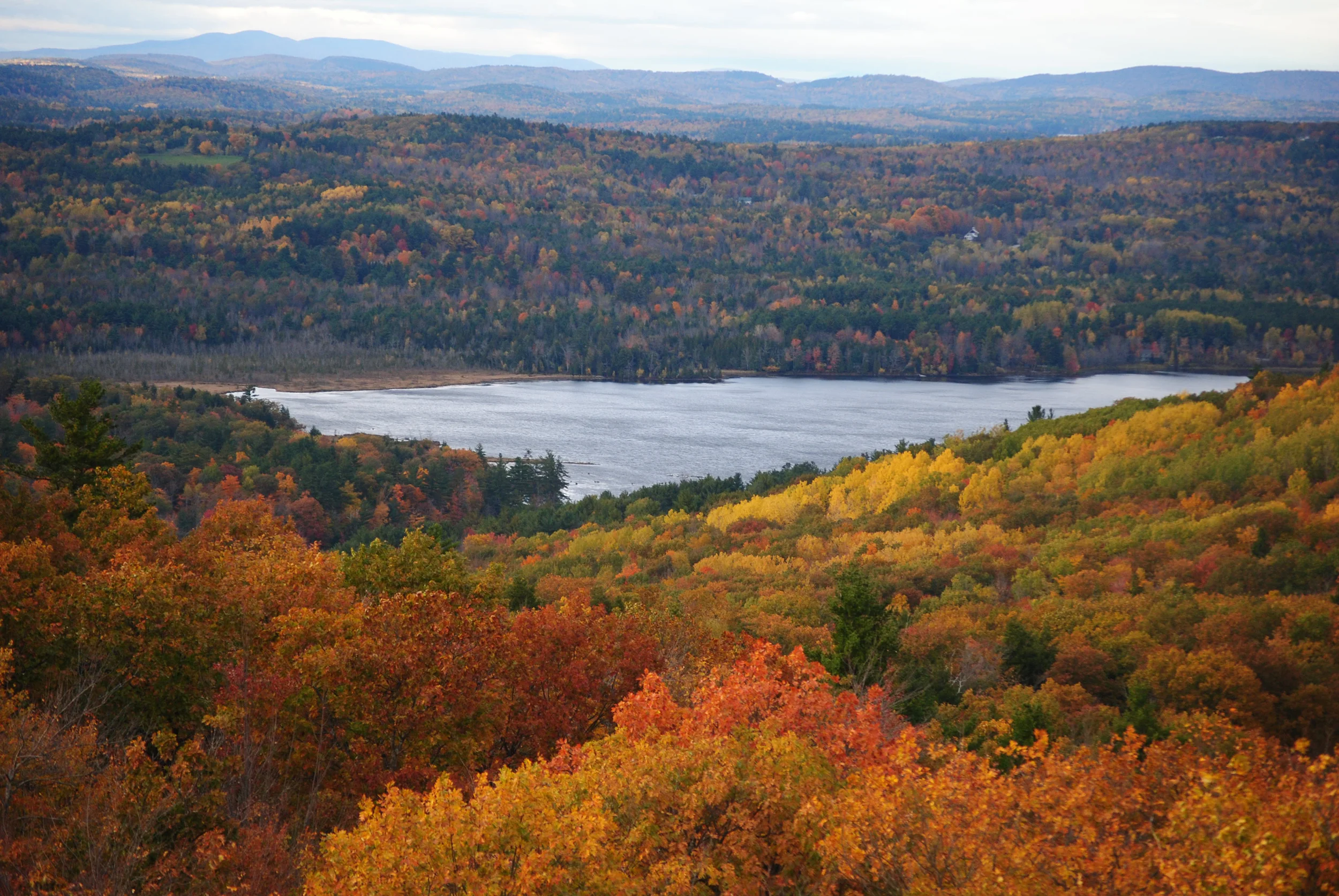
Photo Credit: Brian Kent
Location and Description:
Location: Wayne and Winthrop, Maine
Property Description: Maine families have enjoyed hiking and blueberrying on Mount Pisgah for generations. The Mount Pisgah Fire Tower property, 94 acres owned by the Town of Winthrop and protected with an easement held by KLT, is part of the Trust’s 1,100-acre Conservation Area. The forested summit of Mount Pisgah features the former Maine Forest Service fire tower, which was in use from 1949 to 1991. The tower provides spectacular 360 degree views. On a clear day you can see Mount Washington to the west and the Camden Hills to the east.
Directions: From Route 133 in Wayne turn south onto Fairbanks Road. At the end, turn left onto the Mt. Pisgah Road. Travel south about 1.7 miles – the parking lot is on the left. From Route 202, turn onto North Main Street and go into North Monmouth. After about 0.7 mile, turn right on New Road, which becomes Mt. Pisgah Road. Continue for approximately 1.6 miles – the parking lot is on the right.
No-parking restrictions are in place alongside the roadway to help with crowding and traffic/road safety. DO NOT park on the abutting property of the neighbors or block access to their property.
Usage and Trails
Allowable Uses: hiking, nature observation, cross-country skiing, snowshoeing, hunting in season. Snowmobiles are permitted seasonally on designated trails only. Dogs are allowed on a leash or under voice command. Please clean up after your pets.
Tower Trail: 0.7 mile moderate trail that passes by gnarly old sugar maples and climbs to the 60-foot tower, which is open to the public.
Blueberry Trail: 1.3-mile on KLT-owned land, features stone walls, former fields now grown up to woodlands, and wintertime views to eastern hills. The trail crosses a small clearing which was used as a seasonal cattle pasture. KLT plans to enlarge this opening to encourage the growth of wild blueberries.
Parking: Parking lot on the right, look for KLT sign.

Photo Credit: Emily Perkins
History:
For thousands of years, long before Winthrop was settled by 18th century farmers, the lands around Mt. Pisgah were valued by Native Americans. Nearby, Wilson Pond and Androscoggin Lake were important pre-historic passageways for Abenakis crossing between the Androscoggin and Kennebec Rivers.
In Hebrew, ‘Pisgah’ means a lookout or place with a view, and refers to the place on Mt. Nebo from which Moses looked out over the promised lands. In the 19th century, before the fire tower was constructed, the summit of Pisgah was an open pasture that provided panoramic views. Mt. Pisgah has a rich agricultural history. Old stone walls, second growth pine and hardwood forests, and gnarly sugar maples with tap holes tell the story of intensive land clearing, pasturing, cultivation, and farm abandonment.
Mt. Airy Farm, the historic farmstead owned by the father of Maine agriculture, Dr.Ezekiel Holmes, was also on Mt. Pisgah. Holmes brought innovative farming practices to Maine in the mid 1800s, including the introduction of Jersey cows and other livestock. He is best known for his role in securing the Maine College of Agriculture (now the University of Maine at Orono) as an independent institution.
When you hike the Mount Pisgah trails you are walking on 400 million year old rocks that were once sediment at the bottom of the ancestral Atlantic ocean! Over the millennia, the heat and pressure of geologic processes has metamorphosed the sand and mud into the hard rock exposed today and tilted the originally horizontal layering on end. Most recently, the landscape has been scraped over by continental glaciers, leaving distinct grooves in the rock surfaces. In some areas on the mountain where limy formations are present, the soil is enriched providing ideal soil conditions for sugar maple, basswood, white ash, and eastern hophornbeam trees.
The tower was initially constructed in 1949 on leased land, which was purchased by the State of Maine in 1958 to secure its continued use as a forest fire lookout. In 1991, the Maine Forest Service turned to aircraft patrols to detect forest fires, discontinuing use of many southern Maine fire towers, including the tower on Mt. Pisgah. Visitors should use caution when climbing the fire tower.
