
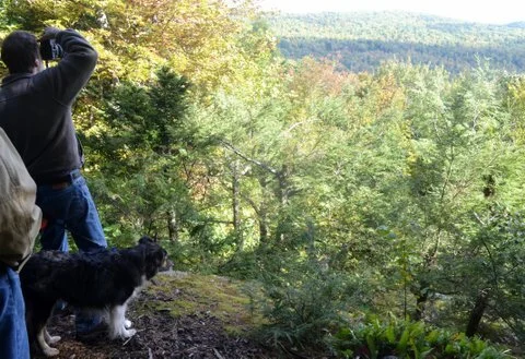
View from Pinnacle. Photo: Brian Kent
Vienna Woods
Location and Description:
Location: Vienna, Maine
Property Description: In March of 2015, Muffy and Jim Floyd donated a 71-acre conservation easement to KLT that will protect valuable wildlife habitat, water quality, working forestland, and hayfields forever. In 2019, the Floyds donated the property in fee to the Kennebec Land Trust. The Vienna Woods Conservation Area is part of a large block of relatively unfragmented woodland that has been valued by people, both resident and migratory, for thousands of years. Located in the Flying Pond watershed at the southern edge of the western Maine foothills, this conservation property contributes to the ecological and economic resilience of the region.
Usage and Directions
Allowable Uses: hiking, nature observation, cross-country skiing, snowshoeing, & hunting. Hunters, please be aware of neighbors and hikers. Dogs are allowed on a leash or under voice command. No mountain biking, horseback riding, or motorized vehicles. Please clean up after your pets.
Trails: The Vienna Woods Trail climbs along the spine of a ridge that was once called the Devil’s Backbone, drops through a mixed hardwood forest, and loops through a stand of mature hemlock, passing a vernal pool and several areas of exposed bedrock in the Hemlock Loop. For more experienced hikers, a steep trail (labeled the Pinnacle Access Trail on the map) heads back uphill to the parking lot.
Directions: From Vienna Village: Take Route 41 northwest from the intersection with Kimball Pond Road. At just over 1.6 miles, turn left onto Trask Road. Continue on Trask Road for 0.4 miles until you reach the end of the paved road. Trailhead parking will be on your left.
History:
The current conservation property and adjacent homestead was a working farm from the 1800s to the mid-1900s. Pottery shards and pieces of metal from old equipment can be found in the soil, and a hand-dug well and cellar hole were filled in for safety reasons. Local residents reported that during WWII the summit of the ridge was cleared and a Civil Defense Observation Tower was erected on it.
